Orientation with compass: Part 1

For the orientation with compass there are two options – either you can see your destination in the terrain, and aiming at, or you can use it in combination with a map.
Setting the compass
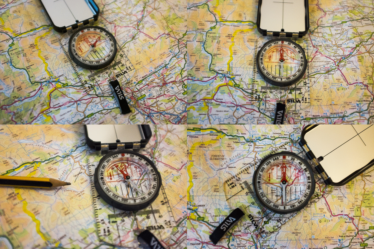
The compass can display more than just the north. Where the ability to display this direction is the basis for what else he can (south of the Equator by the way you need a compass pointing south). To work with a map, this must be northed at first. For this, the compass is applied to a grid line or applies it to the left or right side of the card and turn both until map and compass shows north. So if you have a map with grid pattern (UTM grid), the compass can be mess with the east-west belt of the citynames. Because on a map is always above the north, the place names from West to East are written.
Determine the marchingnumber
Fix the map. The Compass now lay at the startpoint – and end points are at the compass edge. Now the north on the compassring by rotating the compass needle brought into conformity. At the festbrand, the marchingnumber now can be read. For safety reasons this should be written down, because the ring can be adjusted. IMPORTANT: The compass should lay like you held it in the grounds. (Running direction).
Alternative planpointer
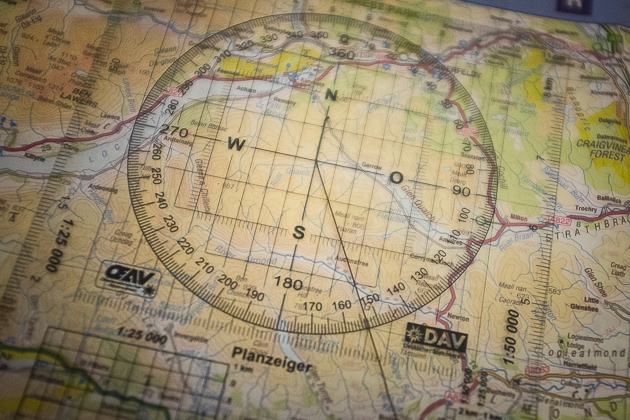
Eayier is the whole thing with a planpointer. For this purpose, the card must not be facing north, but uses directly with the helplines. The plan is centered pointer placed on the starting point and with a cord (yarn or fishing line) a line will be added to the destination point. The pitch circles are here precisely to read than on a map. Mostly you want not drawing on the map, or uses too thick pen. The latter often means that the decision must be made between a plurality of values.
Military Compasses have only 64 ticks. The origin lies in the 6400 line, which correspond to one kilometer an accuracy of one meter. AIUs space reasons, there are only 64 strokes on the Compasses. Decreases accuracy but at 100 meters.
The 360 ticks, which has a civilian compass / mappointer, are more accurate. Quite apart from the fact that probably no one will use a military compass. In addition, the schedule pointer in 360 divisions is divided. Why should first work be facilitated to convert then again complicated?
Sighting targets
Alternatively, can be oriented with the compass by a sighted the target and then the marchingnumber is established. These required a compass, because as when shooting over iron sights the target be kept in mind while and is placed above the level N and compass needle to match. This is a simple method if you can see your target from the starting point. This luxury won´t be granted over the entire distance. In a sink or in the jungle must be sure in which direction the target is.
Orientation after marchingnumber
When the marchingnumber is determined, then it is important to remain stubbornly on the line. No matter what. For this reason it is advisable to seek assistance objectives. If the path is known, and a tree stands in the way, that’s not necessarily bad. This tree can be started even in an indirect way. At the tree arrived, you simply set its sights on the next target. This reduces the risk despite marchingnumber, astray. It is only important to know which route has already been traveled, should have been determined with the marchingnumber also a distance.
Orientation with compass Part 2


Leave a comment